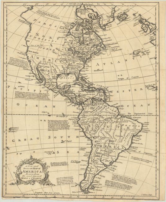
Subject: Western Hemisphere - America
Period: 1760 (circa)
Publication:
Color: Black & White
Size:
11 x 13.9 inches
27.9 x 35.3 cm
This surprisingly rare map of the Americas presents the English colonies extending to the Mississippi River (and beyond in North Carolina's case). Numerous forts are located west of the Great Lakes and along the Mississippi and Missouri rivers. The northwestern part of the continent is almost entirely blank and noted as "Undiscovered" save for a River of the West extending from Cape Blanco to an unnamed lake. Just above the Arctic Circle is the notation "Lands seen by Capt.n Spanberg in 1728 from Whence the Russians fetch beautifull furrs." South America has a developed coastline and river system, though the southern coast of Argentina is noted as "Desert Coast little known" and the fictitious Laguna de Xarayes persists. The oceans are filled with copious notations and a lovely strapwork cartouche. We found no past sales records for this map in the last 30 years.
References:
Condition: B+
Issued folding on watermarked paper with a few short archivally repaired fold separations. There are a few minor chips along the bottom border with a tiny amount of border drawn in facsimile.