Subject: Western Hemisphere - America
Period: 1750 (circa)
Publication:
Color: Hand Color
Size:
17.9 x 11.6 inches
45.5 x 29.5 cm
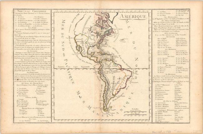
Interesting map of the Americas with the northwest coast of North America extremely truncated. The British colonies are confined to the eastern seaboard, France controls most of the interior, and Spain possesses Mexico and the West Coast. South America shows Portugal in possession of Brazil, France controlling Guiana and Spain in possession of the rest of the continent. Sparse interior details. The map is flanked by panels of text with 12 topics related to the Americas, including its location in relation to Europe, its products, and the names of various features. Overall dimensions given; map is 9.5 x 11".
References:
Condition: B+
A nice impression with contemporary outline color, minor offsetting, a few spots of foxing, and light toning along the centerfold and edges of the sheet.