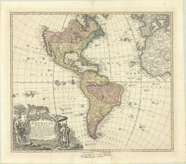
Subject: Western Hemisphere - America
Period: 1746 (dated)
Publication:
Color: Hand Color
Size:
21.5 x 18.5 inches
54.6 x 47 cm
This is a handsome, decorative eighteenth century map of the Americas with considerable detail throughout. It extends to the western part of Africa and southwest Europe. There is only an amorphous coastline shown above the peninsular California, with the Pacific Northwest left blank. The very large title cartouche includes two erupting volcanoes, Native Americans, palm trees, sugar cane, parrots, and a pot of gold. Johann Matthias Haas was a professor of mathematics at Wittenberg, and he worked with the Homann Heirs updating their map stock.
References:
Condition: A
A crisp impression with contemporary color on a clean sheet. There are archival repairs to two short edge tears at bottom and a centerfold separation at top, all confined to the blank margins. The sheet edges have been reinforced on verso with archival material.