Subject: References, Blaeu
Period: 1993 (published)
Publication:
Color: Black & White
Size:
20.5 x 16.1 inches
52.1 x 40.9 cm
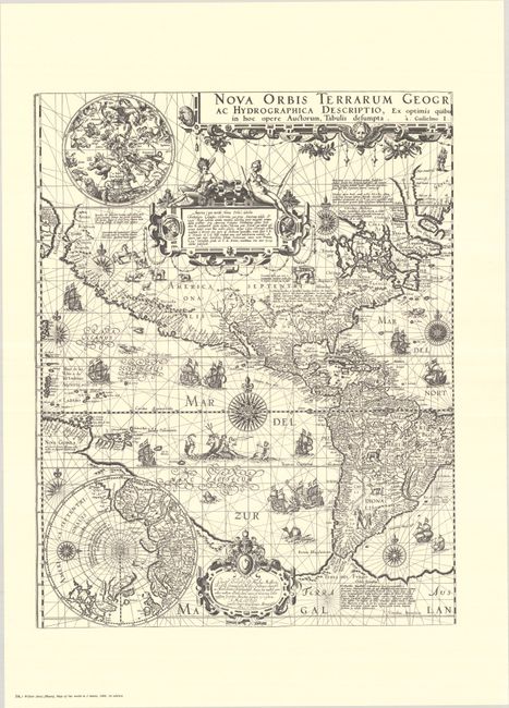
This is the fourth volume in this incredible series on the history of cartography. The fourth volume focuses on the highly decorative single-sheet maps of Willem Jansz Blaeu. Text volume in both Dutch and English, 364 pp., profusely illustrated, together with the portfolio containing 23 full-size facsimile reproductions on 37 sheets. Among the maps reproduced in the folio are Blaeu's world map on Mercator's projection (the 2-sheet version in both its first and third states and the folio edition); his maps of the Seventeen Provinces and Holland (in their 1604 and 1608 editions); a map of the Beemster before and after the "impoldering"; his 1617 maps of Europe, Africa, and Asia; and the second state of his America map, as well as a couple of impressive engravings of sea battles. Hardbound in blue cloth with gilt embossed titles.
References:
Condition: A
Map facsimiles are crisp impressions on bright sheets. Text is clean and tight. Covers of text volume and portfolio have minor soiling, otherwise near fine.