Subject: Geography Books
Period: 1604 (published)
Publication:
Color: Black & White
Size:
4.1 x 6.2 inches
10.4 x 15.7 cm
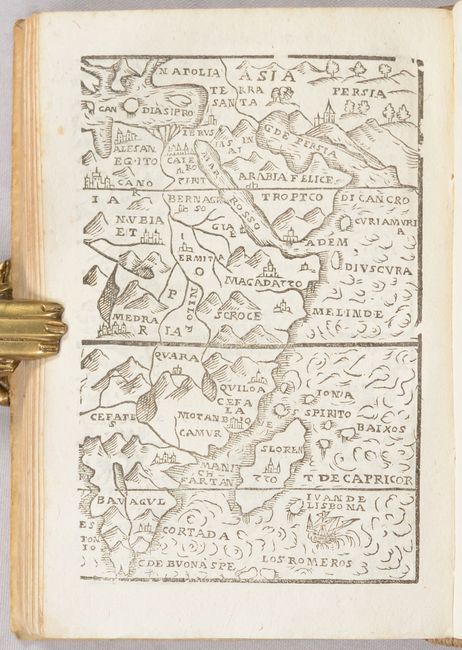
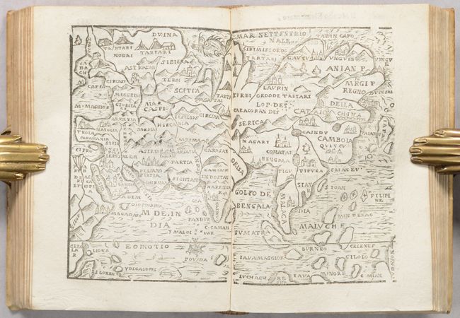
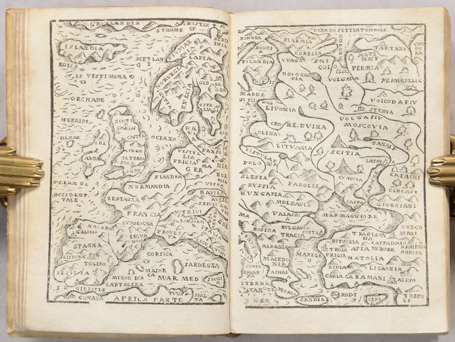
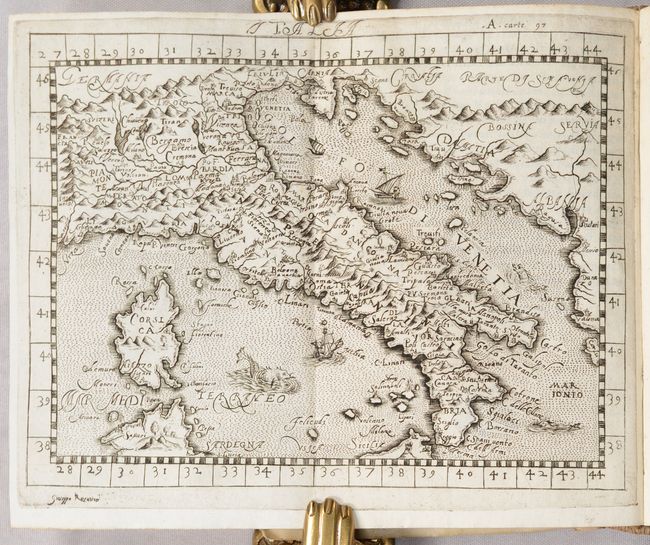
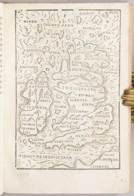
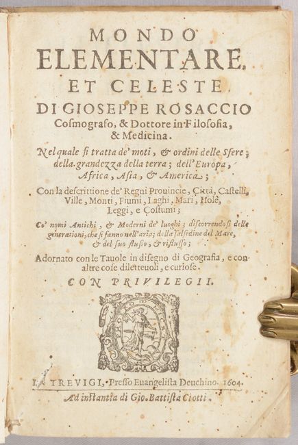
Guiseppe Rosaccio published a number of different geography books that featured miniature woodcut maps, beginning in 1592 and typically under the titles of Il Mondo and Teatro del Cielo o della Terra. Rosaccio only published one edition titled Mondo Elementare, et Celeste, which used the same maps as the previous geographies and was printed by Evangelista Deuchino in Treviso. It includes 14 maps interspersed in the text depicting the world, Europe, Asia, Africa, western hemisphere, Britain (2), Spain & Portugal, France, Germany, Italy, Sardinia & Sicily, Eastern Europe, and the Balkans. Most of the maps are double-page and printed from two separate woodblocks, with the exception of the world map, which is half a page, and the maps of Britain and Sardinia/Sicily, which are single page. The two halves of the double-page maps of the Balkans and Africa were each printed on the same leaf, with half the map on the front of the leaf and half the map on the back. All but one of the maps are woodcut maps that were carved in a crude, but charming manner, bearing no titles. The exception is the map of Italy, which was engraved on copper and was likely specially engraved for this edition as it does not appear in Rosaccio's other geography books. Additional maps of interest are:
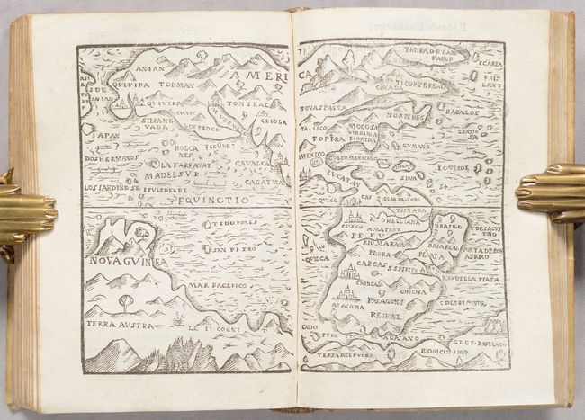
Americas. This small map of the Americas was loosely based on Ortelius, although the detail and engraving are much more simplistic in this map. A huge southern continent extends the entire length of the map, encompassing Nova Guinea and Terra del Fuego. Several important place names appear in North America, including Siera Nevada, Quivira (twice), Nova Spagna, Virginia, Florida, and Canada. A large city is depicted at the northern end of the Gulf of California, which is labeled M. Vermelo. Reference: Burden #89.
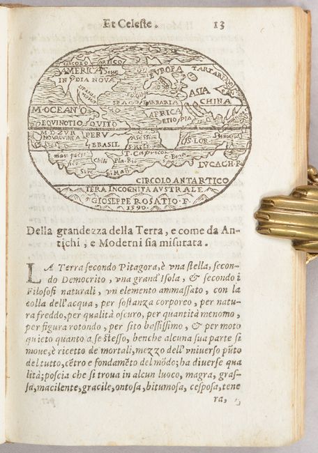
World. The map of the world shows the continents with a very large southern continent. There is very little detail, although Quito, Nova Guinea, S. Lor. (Madagascar), and Lucach R. in the southern continent are all named. Reference: Shirley #178.
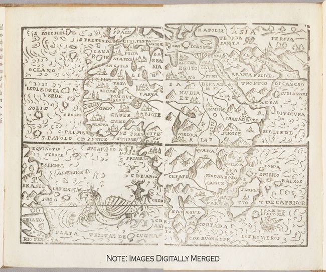
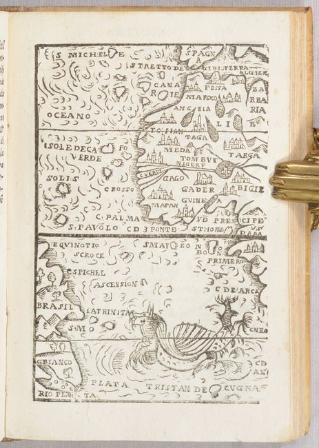
Africa. This miniature map of the continent includes Madagascar, here S. Loren. In the upper right corner is a part of Asia extending to Persia and in the lower left corner is the coastline of Brasil. Africa is filled with mountains and a few places represented by large castles. The Nile River originates well south of the Equator in two lakes. In the sea is a small ship and a very fanciful dragon-like sea monster. Reference: Betz #30.
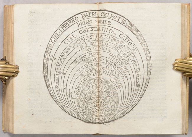
The book also includes a single-page and a double-page diagram of the universe, with hell at the center and heaven on the outer ring. 243 pages with 13 woodcut maps, 1 copperplate map, and 2 woodcut diagrams. Bound in contemporary vellum with old manuscript ink title on spine.
References: King (3rd ed.) #1592; Mickwitz & Miekkavaara #251; Sabin #73196.
Condition: A
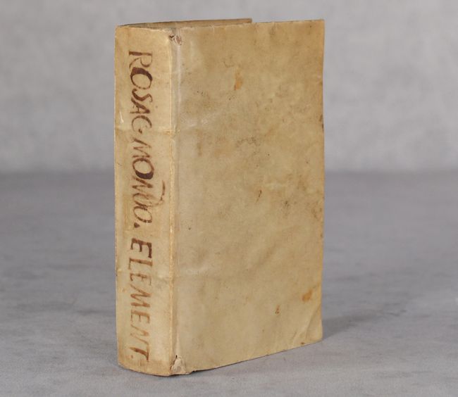
The maps and text are clean and bright with minor occasional soiling or foxing. The title page is stained and there are old manuscript notations on the front and back free-endpapers. A worm track affects the front free-endpaper and the title page. The covers are soiled and worn but still well intact.