Subject: Eastern Africa
Period: 1674 (circa)
Publication:
Color: Black & White
Size:
36.3 x 13.9 inches
92.2 x 35.3 cm
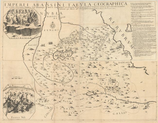
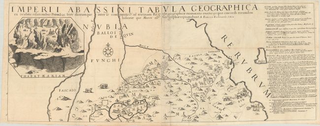
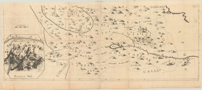
This scarce four-sheet map was produced by little-known Italian mathematician Francisco Eschinardi (Eschenard). The map focuses on the region around today's Sudan, Ethiopia and Eritrea, extending from the Nile River east to the Red Sea. The map is filled with elaborate mountain ranges, long rivers, place names, and fantastic depictions of both natives and animals including camels, elephants, lions, and a ferocious bear-like creature attacking a boat in a lake named "Bardambea." Features inset maps of the mountaintop "Thabat Mariam" at top left and the source of the Nile River at bottom left. A table with place name descriptions fills the right-side of the upper sheet. The sheets have been joined into a northern and southern pair. Not listed in Norwich or Betz.
References:
Condition: B+
Issued folding on watermarked paper with some minor creasing, light offsetting, and a few spots of foxing. A couple of short fold separations along the bottom edge of the southern sheet have been closed on verso with old tape. The first image has been digitally joined - the map is on two horizontal sheets (see the second and third image for zooming).