Subject: Egypt
Period: 1676 (published)
Publication: Introductionis in Universam Geographiam
Color: Hand Color
Size:
8.3 x 6.3 inches
21.1 x 16 cm
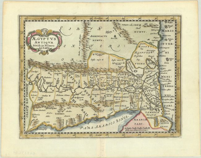
This charming small map is oriented with north on the right. It presents a detailed picture of the region between the fertile Nile River valley and the Red Sea. The map is adorned with a strapwork title cartouche with a credit to Pierre du Val.
Cluver's Introductio in Universam Geographicam was a popular atlas, appearing in over 45 editions during a 100-year period. The first edition was published without maps in the 1620s, and the first edition to include maps was published circa 1641. The various editions were published in different cities throughout Europe, including Amsterdam, Nuremberg, and London, often with new sets of maps engraved. This map is from an Amsterdam edition published by Jansson's heirs, which included some maps from the Jansson and Cloppenburgh editions of Atlas Minor.
References: Shirley (BL Atlases) T.CLUV-6a #44.
Condition: A
A dark impression on a bright sheet with minor toning along the edges.