Subject: Northwestern Africa
Period: 1728 (circa)
Publication:
Color: Hand Color
Size:
22.2 x 19.1 inches
56.4 x 48.5 cm
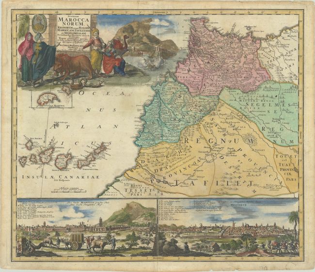
This large and very graphic map shows the domains of desert tribes by means of little tent cities. It extends to include the Canary Islands and an inset of Madeira. In the upper left corner there is a large pictorial cartouche with merchants, soldiers, wild animals, a view of Tangier, and a sea battle. Below the map there are two insets featuring panoramic city views of Morocco (Marrakech) and Mequinetz (Meknes).
References: Norwich #300.
Condition: B+
Contemporary color in the map with later color in the cartouche and insets, on a sheet with the heart-shaped watermark of Sebastian Heerdegen. There is light soiling, an old crease at bottom center that has been archivally reinforced on verso, and a few minor chips along the edges of the sheet.