Catalog Archive
Auction 208, Lot 60
"[Mountains & Rivers] Physical Geography", Black, Adam & Charles
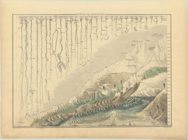
Subject: Cartographic Miscellany, Mountains & Rivers
Period: 1850 (circa)
Publication: General Atlas
Color: Hand Color
Size:
14.3 x 10.3 inches
36.3 x 26.2 cm
Download High Resolution Image
(or just click on image to launch the Zoom viewer)
(or just click on image to launch the Zoom viewer)