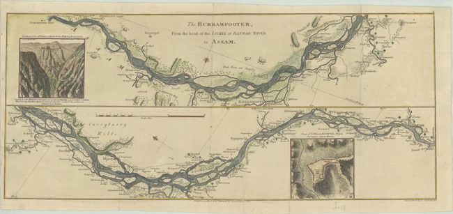
Subject: Brahmaputra River
Period: 1786 (dated)
Publication:
Color: Hand Color
Size:
23.3 x 10.1 inches
59.2 x 25.7 cm
This sheet includes two strip maps showing the course of the Brahmaputra River through Bangladesh and northeastern India. Two insets feature a view and a plan of "Dellamcotta Fort" drawn by Captain Claude Martin. The fort was taken by Captain John Jones in April 1773 on behalf of the British East India Company. The maps were originally drawn by James Rennell, the Surveyor General of the East India Company, and published in A Bengal Atlas circa 1780. This example was copied by C. C. Glassbach for a later publication.
References:
Condition: A
A crisp impression, issued folding on a sheet with a large "4" watermark, now flattened. There is minor marginal soiling.