Subject: Philippines
Period: 1900 (dated)
Publication:
Color:
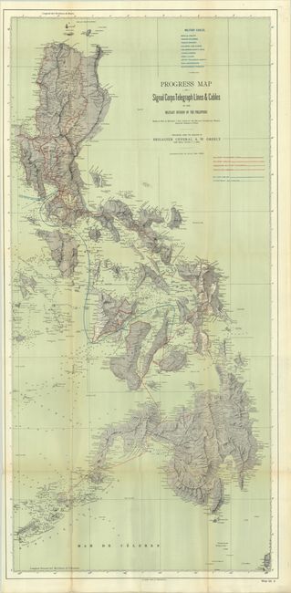
A. Progress Map of Signal Corps Telegraph Line & Cables in the Military Division of the Philippines…, printed color (20.3 x 42.1"). This map illustrates the progress made by the Army in laying 10,000 miles of telegraph lines and cables that became the basis of the communications infrastructure of the Philippines. Red and blue overprinting identify military telegraph lines and cables, projected military lines and cables, and British cables. 10 cables are listed at top. In addition to the communications information, the map shows topography with an excellent three-dimensional perspective.
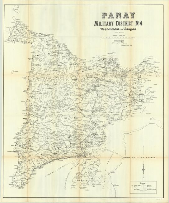
B. Panay Military District No. 4 Department of the Visayas, black & white (32.3 x 38.5"). This large and detailed map of the island of Panay shows towns, boundaries, telegraph lines, roads, and even foot paths. Panay was the site of major activity in the Philippine-American War.
References: Phillips (Philippines) #616 & #692.
Condition: B+
Issued folding with light toning along the fold lines and several short splits at the fold junctions.