Catalog Archive
Auction 208, Lot 582

"Les Isles Philippines, celle de Formose, le Sud de la Chine, les Royaumes de Tunkin, de Cochinchine, de Camboge, de Siam, des Laos...", Bonne, Rigobert

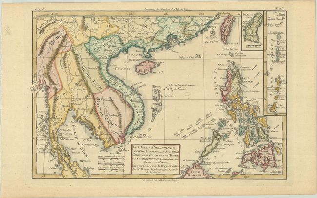
Subject: Southeast Asia

Period: 1780 (circa)

Publication: Atlas de Toutes les Parties Connues du Globe Terrestre

Color: Hand Color

Size:
12.8 x 8.5 inches
32.5 x 21.6 cm
Download High Resolution Image
(or just click on image to launch the Zoom viewer)

Attractive copper engraved map covering Indochina, southern China, Taiwan, and the Philippines. Two insets provide detail of Guam and the Mariana Islands. Trade winds are shown with arrows and marked with the months in which the winds are predominant.

Rigobert Bonne was an important French cartographer of the late 18th century. In 1773 he succeeded Jacques Bellin as the royal cartographer in the office of the Hydrographer at the Depot de la Marine. Working in his official capacity, Bonne compiled some of the most detailed and accurate maps of the period.

References:

Condition: A

A nice impression on a sturdy sheet with minor toning.

Estimate: $160 - $190

Sold for: $220

Closed on 4/22/2026

Archived