Catalog Archive
Auction 208, Lot 58
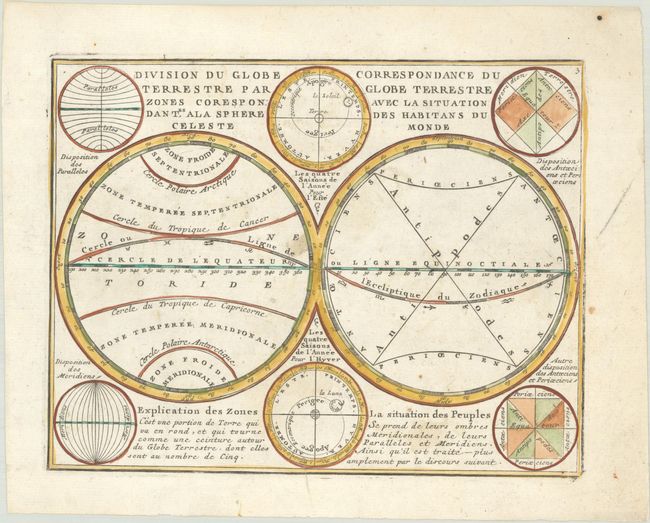
"Division du Globe Terrestre par Zones Corespondantes ala Sphere Celeste / Correspondance du Globe Terrestre avec la Situation des Habitans du Monde", Chiquet, Jacques
Subject: Cartographic Miscellany, Geography
Period: 1719 (published)
Publication: Le Nouveau et Curieux Atlas Geographique et Historique
Color: Hand Color
Size:
8.6 x 6.6 inches
21.8 x 16.8 cm
Download High Resolution Image
(or just click on image to launch the Zoom viewer)
(or just click on image to launch the Zoom viewer)