Subject: Eastern, Southern & Southeast Asia
Period: 1730 (circa)
Publication:
Color: Hand Color
Size:
24.5 x 23.9 inches
62.2 x 60.7 cm
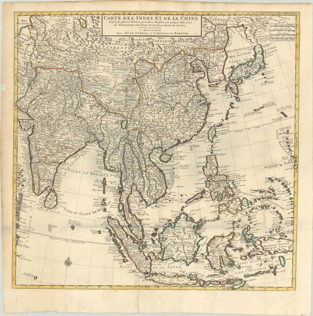
This large, attractive map covers the vast region extensively explored by the Europeans with particular emphasis on the trade routes on the mainland and the islands of the Philippines and the East Indies. In Japan, Hokkaido (Terre d' Yeco ou d'Eso) is attached to the Asian mainland, and the Sea of Japan is named Mer Orientale ou Mer de Coree. Korea is correctly shown as a peninsula, although much too wide. The mythical Lac de Chaamay appears in present-day Burma with several rivers flowing south. The map is filled with details of towns, roads, rivers and topography. Two sheets, joined, as issued.
References:
Condition: B+
A sharp impression with contemporary outline color, issued folding on bright sheets with very light offsetting, a small hole at the fold intersection, and a small spot east of the Maldives. There is light toning along the edges of the sheet.