Subject: Asia
Period: 1676 (published)
Publication: Introductionis in Universam Geographiam
Color: Hand Color
Size:
10 x 7.2 inches
25.4 x 18.3 cm
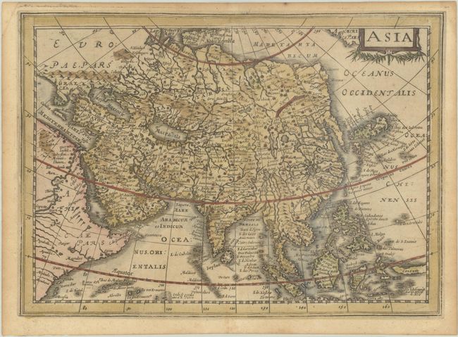
Attractive copper-engraved map of the continent that extends to include North America partially obscured by the title cartouche at upper right, labeled America Pars. The outline of Asia follows the Mercator-Hondius model with the Arctic and extreme northeast coastlines truncated, an elongated Korean Peninsula, and a narrow Indian Peninsula. There are numerous place names throughout. In China, the Great Wall is prominently depicted and there is a bold network of rivers and large lakes. The mythical Lake Chiamay appears unnamed in western China with five rivers flowing south. This map was engraved for Cloppenburg's small Atlas, and later used for an edition of Cluver's Introductio in Universam Geographicam.
Cluver's Introductio in Universam Geographicam was a popular atlas, appearing in over 45 editions during a 100-year period. The first edition was published without maps in the 1620s, and the first edition to include maps was published circa 1641. The various editions were published in different cities throughout Europe, including Amsterdam, Nuremberg, and London, often with new sets of maps engraved. This map is from an Amsterdam edition published by Jansson's heirs, which included some maps from Jansson's Atlas Minor.
References: Shirley (BL Atlases) T.CLUV-6a #32; Van der Krogt (Vol. III) #8000:353; Yeo #49.
Condition: B+
A lightly toned sheet with one tiny hole in the Caspian Sea caused by a paper flaw.