Subject: Persia - Iran
Period: 1676 (published)
Publication: Introductionis in Universam Geographiam
Color: Hand Color
Size:
7.5 x 5.9 inches
19.1 x 15 cm
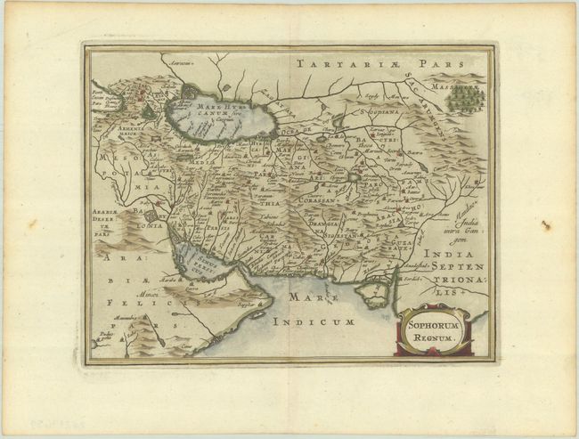
Charming small map of the Persian Empire covering the region from the Caucasus to India with part of the Arabian Peninsula. The Caspian Sea is depicted in a horizontal oval shape. Nice detail identifies dozens of tiny villages. Strapwork cartouche encloses the title.
Cluver's Introductio in Universam Geographicam was a popular atlas, appearing in over 45 editions during a 100-year period. The first edition was published without maps in the 1620s, and the first edition to include maps was published circa 1641. The various editions were published in different cities throughout Europe, including Amsterdam, Nuremberg, and London, often with new sets of maps engraved. This map is from an Amsterdam edition published by Jansson's heirs, which included some maps from the Jansson and Cloppenburgh editions of Atlas Minor.
References: Shirley (BL Atlases) T.CLUV-6a #37.
Condition: A
A dark impression on a bright sheet with minor toning along the edges of the sheet and a couple of small stains in the blank margins.