Subject: Jerusalem, Holy Land
Period: 1716 (circa)
Publication:
Color: Black & White
Size:
18 x 12.1 inches
45.7 x 30.7 cm
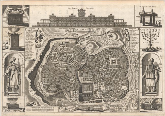
Great bird's-eye plan of ancient Jerusalem after Juan Bautista Villalpando's plan. Engravings of temple vessels, religious icons, Solomon and a high priest flank the plan. At the top is a large elevation of the Temple of Solomon. This map was originated by Bastiaan Stoopendaal in 1688, and then revised by Daniel Stoopendaal. Published by Jacob and Pieter Keur. Dutch text on verso.
References: Poortman & Augusteijn #142-KII-2.
Condition: B+
A superb impression, issued folding, with archival repairs to short separations along the folds at bottom and to a few short tears along the edges of the sheet.