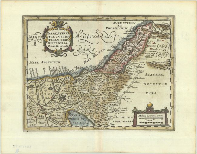
Subject: Holy Land
Period: 1676 (published)
Publication: Introductionis in Universam Geographiam
Color: Hand Color
Size:
7.9 x 6 inches
20.1 x 15.2 cm
A charming small map that covers the region from Egypt to Sidon illustrating the Exodus and the wanderings of the Children of Israel. The map is adorned with strapwork title and distance scale cartouches. Engraved by Petrus Kaerius.
Cluver's Introductio in Universam Geographicam was a popular atlas, appearing in over 45 editions during a 100-year period. The first edition was published without maps in the 1620s, and the first edition to include maps was published circa 1641. The various editions were published in different cities throughout Europe, including Amsterdam, Nuremberg, and London, often with new sets of maps engraved. This map is from an Amsterdam edition published by Jansson's heirs, which included some maps from the Jansson and Cloppenburgh editions of Atlas Minor.
References: Laor #395; Shirley (BL Atlases) T.CLUV-6a #40.
Condition: A
A dark impression on a bright sheet with minor toning along the centerfold and edges of the sheet. There is a small chip in the bottom margin.