Subject: Middle East
Period: 1747 (circa)
Publication: An Universal History, from the Earliest Account of Time...
Color: Black & White
Size:
14.2 x 10.6 inches
36.1 x 26.9 cm
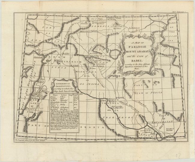
This historical map extends from the eastern Mediterranean to the Caspian Sea and Persian Gulf, presenting ancient kingdoms, a handful of cities, rivers, and topography. Paradise, Babel, and Mount Ararat are each located on the map in three different locations according to the "three different Hypotheses mentioned in this Work." A table of cities with coordinates is located in a blank area of the map. This map was issued in volume 1 of A Universal History..., a a massive 65-volume work published from 1747–68 that attempted to chronicle world history from ancient times. PJ Mode further notes "the Age of Discovery led in the 17th century to persistent pressure for Christian theology to identify the precise location of Paradise in order to validate the text of Genesis." While the map itself is anonymous, it was likely produced by either John Gibson, Thomas Kitchin or Bradock Mead.
References: PJ Mode Collection #1023.
Condition: B+
Issued folding with faint offsetting and an archivally repaired 1" binding tear at right. Binder's trim at lower right has been replaced with Japanese tissue.