Catalog Archive
Auction 208, Lot 515

"A Mapp of the Estates of the Turkish Empire in Asia, and Europe Designed by Monsr Sanson Geographer to the French King, and Rendered Into English...", Blome, Richard

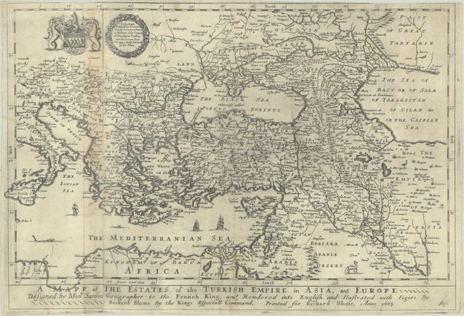
Subject: Eastern Mediterranean & Middle East

Period: 1669 (dated)

Publication: A Geographical Description of the World...

Color: Black & White

Size:
15.9 x 10.9 inches
40.4 x 27.7 cm
Download High Resolution Image
(or just click on image to launch the Zoom viewer)

This map of the Turkish Empire is filled with towns, river systems, mountains and political boundaries. It extends from the Gulf of Venice in the east to northern Africa in the south and the Black Sea in the west. The map is based on the cartography of Nicolas Sanson. It is decorated by a a coat of arms and dedication cartouche to the Levant Company, whose charter was to regulate English trade with the Ottoman Empire and the Levant (eastern Mediterranean). The map therefore illustrates the company's monopoly in the region.

Richard Blome was one of the most interesting, and most active, publishers of illustrated books in post-Restoration London. There is an excellent biography of Blome on MapForum.com.

References: Shirley (BL Atlases) T.BLOM-1c #3.

Condition: B+

Issued folding and now flat with a few printer's creases and some light staining along the joint at left.

Estimate: $220 - $250

Sold for: $160

Closed on 4/22/2026

Archived