Subject: Celestial
Period: 1973 (dated)
Publication:
Color: Printed Color
Size:
45.8 x 33.9 inches
116.3 x 86.1 cm
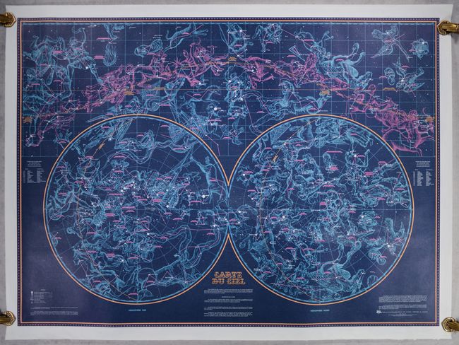
This vivid "Sky Map" was published by the Institut Geographique National (IGN) in Paris. It shows the major constellations both as they appear in the sky above (at top) as well as in spheres (at bottom) centered on the northern and southern equatorial poles. The map also indicate the stars that are visible to the naked eye for each month of the year via the ecliptic. The map uses beautiful dark colors to represent the night sky and was "intended for amateur astronomers or people wishing to have a map that is both decorative and complete."
References:
Condition: A
Bold coloring and fully backed with archival tissue. There are a few minor creases in the bottom blank margin.