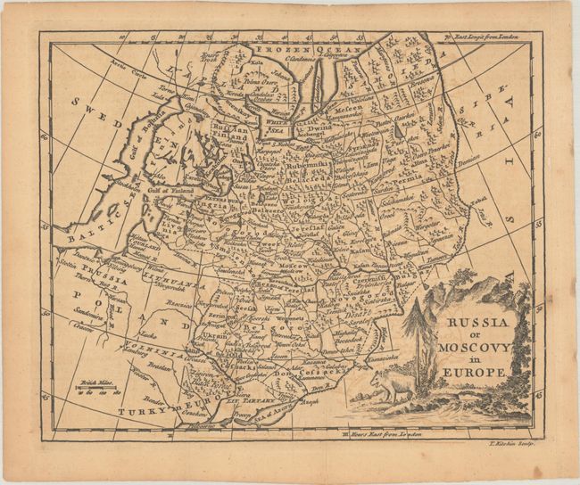
Subject: Russia in Europe
Period: 1770 (circa)
Publication: A New Geographical, Historical, and Commercial Grammar...
Color: Black & White
Size:
8.8 x 7.1 inches
22.4 x 18 cm
This handsome small map spans from the Baltic east to the confluence of the Irtysh and Tobol rivers. Aside from the names of major cities, most of the detail is confined to present-day Russia and Ukraine. The map shows political divisions, towns and cities, rivers, forests, and mountains. Moscow, St. Petersburg, Kyiv, and Kazan are among the cities identified. Detail in the northern expanses is a little shaky, with Kanin Peninsula appearing as a slender island called Candenois. The pictorial title cartouche features a forest scene and a bear-like creature.
References: McCorkle (18th C. Geography Books) #165-4.
Condition: B+
A sharp impression issued folding on a sheet with light toning and offsetting. A couple of tiny fold separations at top have been closed on verso with archival tape.