Subject: Russia in Europe
Period: 1740 (circa)
Publication:
Color: Hand Color
Size:
24.7 x 19.1 inches
62.7 x 48.5 cm
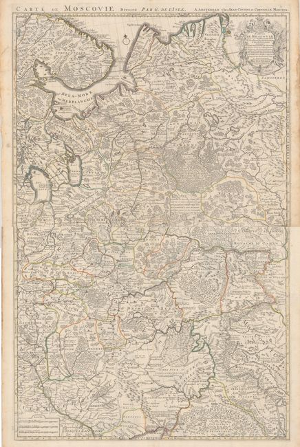
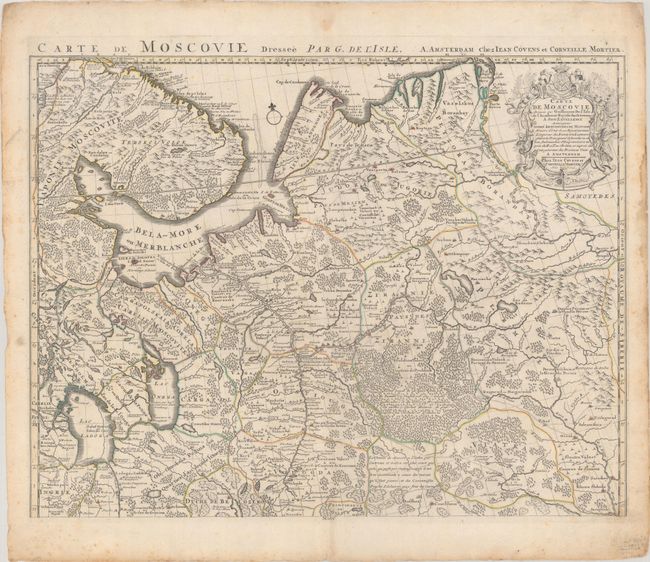
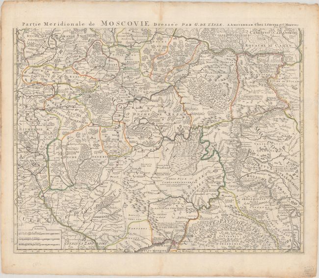
Matched pair of the northern and southern sheets of Delisle's important map of the Russian Empire. Both sheets provide great detail of the towns, roads, forests and topography. The northern map is decorated with a nice title cartouche featuring a sleigh, coat of arms, animals and a hunter. The southern sheet includes Moscow and features three distance scales. Size given is approximate for each sheet. A very attractive example of this map in its original unjoined state. If joined the map would measure approximately 24.3 x 39".
References:
Condition: A
Nice impressions with original outline coloring on very thick hand laid paper with the watermark of "C&I Honig." Marginal soiling or staining, a small amount of roughness at some edges, maps very good. There is some staining, foxing and soiling that is almost entirely confined to the blank margins. The first image is a composite image - the map is on two separate sheets.