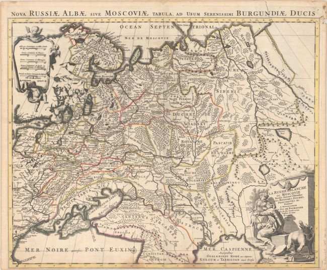
Subject: Russia in Europe
Period: 1695 (dated)
Publication:
Color: Hand Color
Size:
23.9 x 19.3 inches
60.7 x 49 cm
Handsome map showing the extent of the Russian Empire in Europe from the Barents Sea in the north to the Black and Caspian Seas in the south. The political divisions are delineated and the forested areas are graphically shown. A long road extends from the Black Sea nearly to Moscow with a note indicating that the Morawski Slak road follows along the Tartares to reach Moscow. The map is based on the work of Sanson. Putti hold aloft a drape-style cartouche with the distance scales, and the title cartouche features a hunter, a maiden, and a chained bear. An alternate Latin title appears above the map: "Nova Russiae Albae sive Moscoviae Tabula, ad Usuam Serenissimi Burgundiae Ducis."
References:
Condition: B
A sharp impression with contemporary outline color on a bright sheet with a pair of dampstains at bottom. A long tear at top right has been repaired on verso with kraft paper.