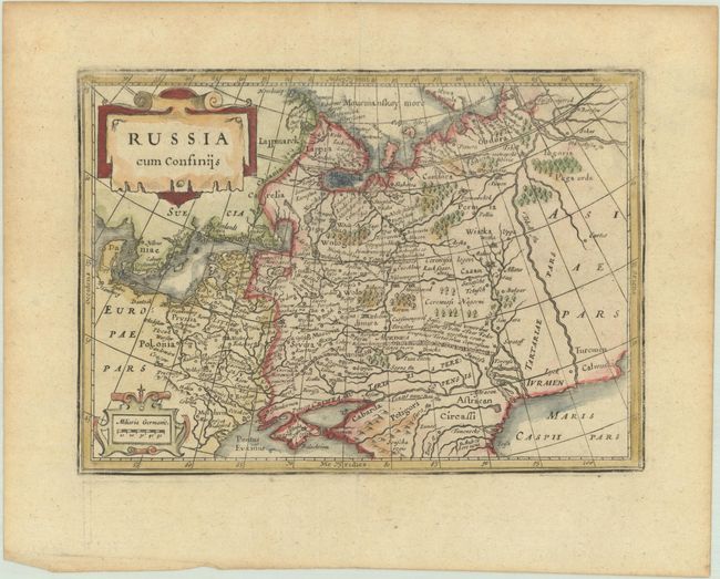
Subject: Russia in Europe
Period: 1676 (published)
Publication: Introductionis in Universam Geographiam
Color: Hand Color
Size:
7.9 x 5.6 inches
20.1 x 14.2 cm
This charming small map shows the Russian Empire in Eastern Europe. It covers the region from Scandinavia to the Caspian Sea. It has nicely detailed pictorial topography, including engraved forests, towns, and mountains. The map is embellished with two strapwork cartouches.
Cluver's Introductio in Universam Geographicam was a popular atlas, appearing in over 45 editions during a 100-year period. The first edition was published without maps in the 1620s, and the first edition to include maps was published circa 1641. The various editions were published in different cities throughout Europe, including Amsterdam, Nuremberg, and London, often with new sets of maps engraved. This map is from an Amsterdam edition published by Jansson's heirs, which included some maps from the Jansson and Cloppenburgh editions of Atlas Minor.
References: Shirley (BL Atlases) T.CLUV-6a #31; Van der Krogt (Vol. III) #1800:352.1.
Condition: B+
Light toning. The impression is a bit weak in some spots along the border.