Catalog Archive
Auction 208, Lot 477
"Carte de l'Empire de Russie, en Europe et en Asie", Bonne, Rigobert
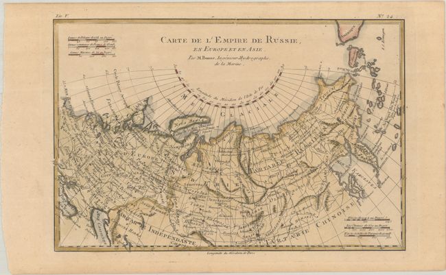
Subject: Russia
Period: 1780 (circa)
Publication: L'Histoire Philosophique et Politique…
Color: Hand Color
Size:
12.7 x 8.3 inches
32.3 x 21.1 cm
Download High Resolution Image
(or just click on image to launch the Zoom viewer)
(or just click on image to launch the Zoom viewer)