Subject: Eastern Europe, Lithuania & Belarus
Period: 1676 (published)
Publication: Introductionis in Universam Geographiam
Color: Hand Color
Size:
9.8 x 7.1 inches
24.9 x 18 cm
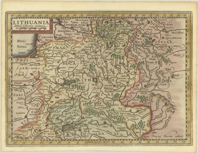
This handsome early map covers all of Lithuania and Belarus. It extends from the Vistula River east to Russia and from Riga south to Ukraine. There is excellent detail, with several towns and cities named and rivers, lakes, and forests (including Nigra Sylva - a "Black Forest" located south of Kyiv). The title and distance scale appear in a block cartouche at top left. Masterfully engraved by Petrus Kaerius for Cloppenburgh's atlas based on Mercator's maps.
Cluver's Introductio in Universam Geographicam was a popular atlas, appearing in over 45 editions during a 100-year period. The first edition was published without maps in the 1620s, and the first edition to include maps was published circa 1641. The various editions were published in different cities throughout Europe, including Amsterdam, Nuremberg, and London, often with new sets of maps engraved. This map is from an Amsterdam edition published by Jansson's heirs, which included some maps from the Jansson and Cloppenburgh editions of Atlas Minor.
References: Shirley (BL Atlases) T.CLUV-6a #30; Van der Krogt (Vol. III) #1730:353.
Condition: A
A nice impression on a bright sheet with minor toning along the edges of the sheet. The margins are a bit narrow, as issued, but still sufficient for framing.