Subject: Southeastern Germany & Northwestern Austria
Period: 1740 (circa)
Publication:
Color: Hand Color
Size:
18.1 x 23.6 inches
46 x 59.9 cm
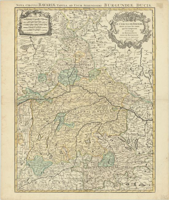
This elegantly engraved map centers on Bavaria and extends to include nearby Imperial States such as Saxony, Salzburg, and Tyrol. In addition to political divisions, numerous towns and cities are located including Munich, Nuremberg, Augsburg, Plauen, Ingolstadt, and Linz. There is excellent topographical detail. There are two ornate cartouches at top: one at left enclosing five distance cartouches, and one at right for the title. Alternate Latin title above the map: "Nova Circuli Bavariae Tabula, ad usum Serenissimi Burguntiae Ducis."
References:
Condition: B+
A sharp impression with full contemporary color on a bright sheet with faint dampstaining along the centerfold and left edge of the sheet. A tear confined to the right blank margin has been closed on verso with paper tape.