Subject: Western Germany
Period: 1640 (circa)
Publication: Theatrum Orbis Terrarum
Color: Hand Color
Size:
19.6 x 15 inches
49.8 x 38.1 cm
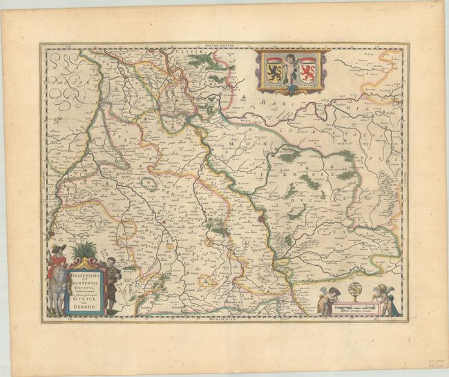
This map focuses on the western part of North Rhine Westphalia. The Rhine River flows through the center of the map from Wesel (unnamed on the map) to Sinzig, including the cities of Dusseldorf and Cologne. The map extends just over the Germany-Netherlands border along the Meuse River to include Maastricht and Venlo. There is nice topographical detail of the rivers, forests, and hills. At top, a cherub holds the coats of arms of Julich and Van Bergh. The distance scale cartouche includes a pair of cherubs with measuring dividers and an armillary sphere, while the title cartouche features a man on horseback with a pistol. Latin text on verso, published between 1640-55.
References: Van der Krogt (Vol. II) #2381:2B.
Condition: A
A nice impression with full contemporary color on a sheet with minor toning.