Subject: Northeastern Germany
Period: 1662 (circa)
Publication:
Color: Hand Color
Size:
20.8 x 15.5 inches
52.8 x 39.4 cm
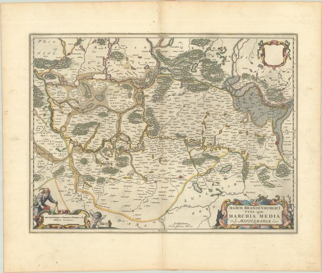
A beautiful and decorative map of what was historically part of Prussia, but since 1945 lies partly in Poland and partly in Germany. This portion of central Brandenburg covers the area west of the Oder River. The map is centered on Berlin, with Frankfurt am Oder at the right and Plawe (Plauen) near the left border. It is beautifully adorned with two cartouches at bottom that feature a surveyor, a hunting dog, and a stag, as well as a blank dedication cartouche at upper right. The title word "March." is an abbreviation for Marchionatus. Scarce, it was first issued in Johannes Blaeu's Atlas Maior in 1662 a short time before the printing house was destroyed by fire. Spanish text on verso, published between 1659-72.
References: Van der Krogt (Vol. II) #2173:2.
Condition: A
A crisp impression with full contemporary color on a sheet with a large watermark of the god Atlas. There is minor toning along the centerfold and a few spots of foxing.