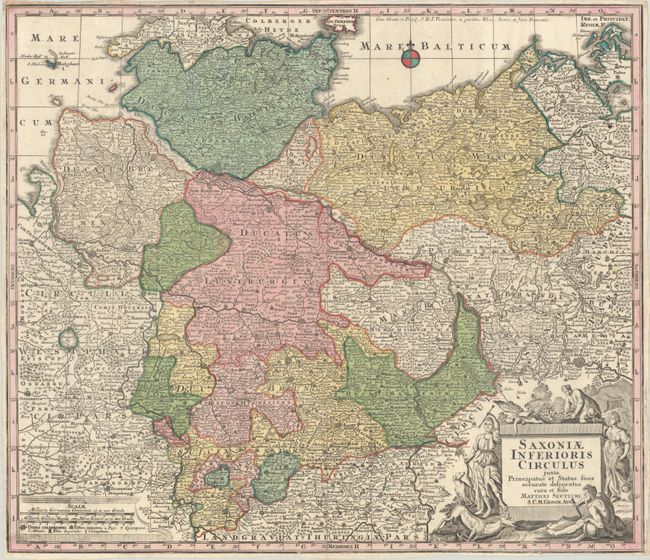
Subject: Northern Germany
Period: 1740 (circa)
Publication:
Color: Hand Color
Size:
22.8 x 19.6 inches
57.9 x 49.8 cm
This handsome map, in the typical German style, is finely engraved and remarkably detailed. The first covers the northwest part of Germany from the Danish border south to Thuringia and from Osnabruck east to Berlin. Scores of rivers and lakes, and hundreds of villages and towns are named including several fortified cities such as Berlin, Bremen, Hamburg, Oldenburg, Hanover, Magdeburg, and Halle A lovely decorative title cartouche features Diana the Huntress and other allegorical figures. The map is enhanced with a small compass rose in the Baltic Sea, and two distance scales in a separate cartouche at lower left.
References:
Condition: B+
A nice impression with full contemporary color on a bright sheet that has been folded vertically and horizontally with a small hole at the fold intersection. Trimmed close to the neatline on all sides.