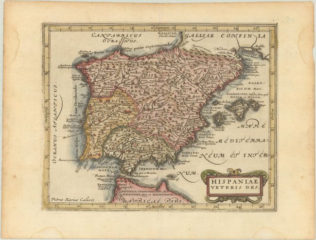
Subject: Spain & Portugal
Period: 1676 (published)
Publication: Introductionis in Universam Geographiam
Color: Hand Color
Size:
7.8 x 6.3 inches
19.8 x 16 cm
Attractive small map of the Iberian Peninsula in classical times. It is based on Ortelius' map of the same title using information gleaned from Clusius' map of 1571, as well as from classical sources. Adorned with a strapwork title cartouche. Engraved by Petrus Kaerius.
Cluver's Introductio in Universam Geographicam was a popular atlas, appearing in over 45 editions during a 100-year period. The first edition was published without maps in the 1620s, and the first edition to include maps was published circa 1641. The various editions were published in different cities throughout Europe, including Amsterdam, Nuremberg, and London, often with new sets of maps engraved. This map is from an Amsterdam edition published by Jansson's heirs, which included some maps from the Jansson and Cloppenburgh editions of Atlas Minor.
References: Shirley (BL Atlases) T.CLUV-6a #5.
Condition: A
A generally dark impression that is a bit weak along the neatline. There is minor toning that is a bit more pronounced along the edges of the sheet, with several light dampstains also along the sheet's edges.