Catalog Archive
Auction 208, Lot 414
Focuses on Nice and Monaco
"[Lot of 2] Carte de l'Etat de Genes ou se Trouvent Nice, Vintimille, S. Remo &c. [and] Carte des Confins de l'Etat de Genes ou se Trouve une Partie du Cie. de Nice", Robert de Vaugondy, Didier
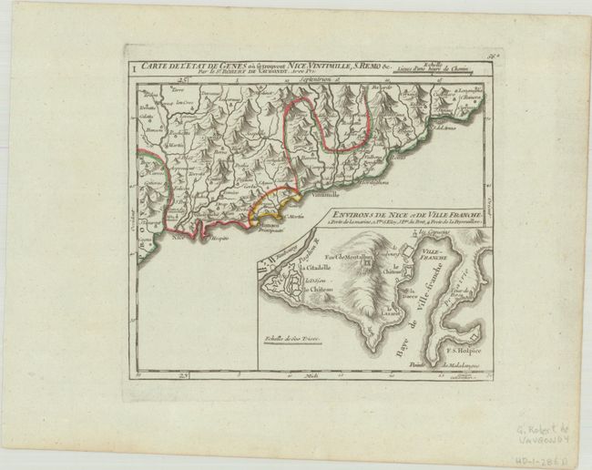
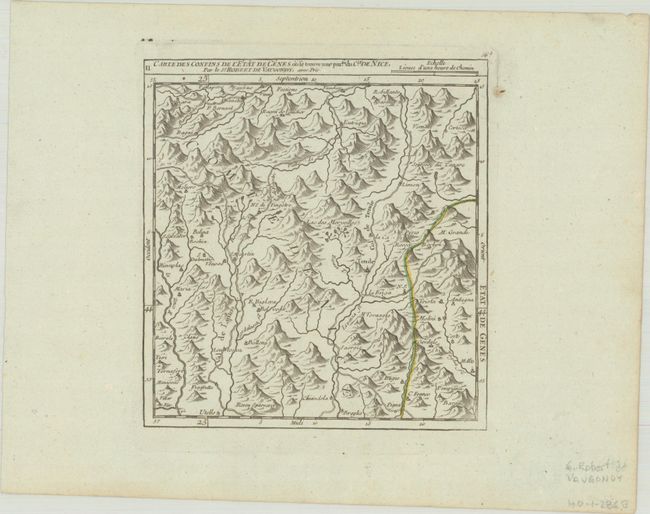
Subject: Southeastern France & Western Italy
Period: 1748 (circa)
Publication: Atlas Portatif Universel
Color: Hand Color
Size:
See Description
Download High Resolution Image
(or just click on image to launch the Zoom viewer)
(or just click on image to launch the Zoom viewer)