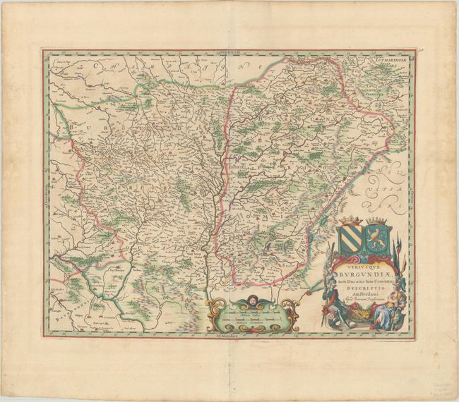
Subject: Eastern France
Period: 1650 (circa)
Publication:
Color: Hand Color
Size:
19.4 x 15.1 inches
49.3 x 38.4 cm
A superb map of the historic Burgundy region in France. Centered roughly on the Saone River, the map extends from Crevant to Montbeliard in the north, and from Varennes-sur-Allier to Geneva at bottom. The map is finely engraved with minute detail and embellished with a bold title cartouche flanked by Mars and one of his consorts. The arms of the Duchy and County of Burgundy top the cartouche, while a cherub peaks out from above the distance scale cartouche. Blank verso, published between 1644-75.
References: Van der Krogt (Vol. I) #4860:1.
Condition: A
A crisp impression with full contemporary color, minor offsetting, and light dampstains along the sides of the sheet, not affecting the image.