Subject: Low Countries
Period: 1631 (circa)
Publication:
Color: Hand Color
Size:
19.5 x 15 inches
49.5 x 38.1 cm
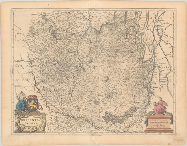
This map depicts the historical region of Brabant, extending from Brussels and Antwerp in the west, to Namur in the south, Maastricht in the east, and Rotterdam in the north. The map is filled with early roads, hundreds of tiny towns, and the extensive river system in the region. Two lovely cartouches feature a queen with the coat of arms of the Duchy of Brabant and a female surveyor. Blank verso.
References: Van der Krogt (Vol. II) #3100:2.
Condition: B+
Attractive old color in the cartouches with an impression that is a bit light at center, on a lightly toned sheet with the watermark of a shield with a bend. There is light soiling at bottom right and a few small worm holes at bottom center.