Subject: Baltic, Latvia & Estonia
Period: 1718 (circa)
Publication:
Color: Black & White
Size:
14.7 x 11.4 inches
37.3 x 29 cm
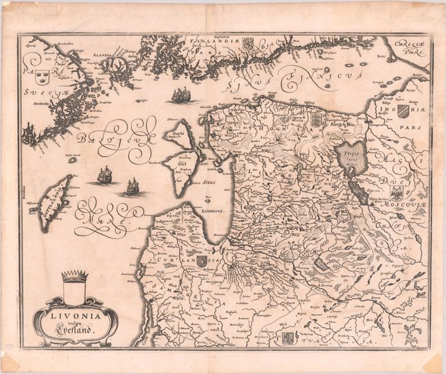
This elegantly engraved map of the Baltic region is based on Blaeu's map of the same title. It first appeared in the seventeenth volume of Merian's Theatrum Europaeum. The map covers the area of present-day Estonia, Latvia, and northern Lithuania, with the Baltic Sea. It also extends to cover the neighboring coastlines of Sweden and Finland and parts of western Russia and Belarus. The map is embellished with sailing ships, a title cartouche, and the coats of arms for Sweden, Finland, Estonia, Courland (Latvia), Lithuania, Moscovia, and Ingria.
References: Shirley (BL Atlases) G.MERI-17a #8.
Condition: B+
A generally sharp impression that is weak along the neatline at right, on watermarked paper with light offsetting and toning. There are tape stains in the blank margins and remnants of hinge tape on verso.