Subject: Wales
Period: 1675 (circa)
Publication: Britannia
Color: Black & White
Size:
17.1 x 12.2 inches
43.4 x 31 cm
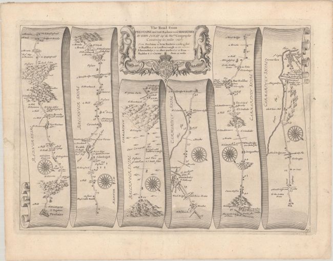
John Ogilby's 'Britannia' was published between 1675 and 1698. It is a landmark in the mapping of England and Wales. Its unique format constituted the first national road-atlas of any country in Western Europe. It was composed of maps of seventy-three major roads and cross-roads, presented in a continuous strip-form, on a uniform scale of one inch to a mile. Each beautiful map includes wonderful detail of the countryside with each strip containing a large compass rose to indicate changes in direction.
This attractive strip-style map covers the road from Presteigne to Carmarthen, through Llandovery and Radnor. It is in the pictorial style pioneered by Ogilby with the road laid out in several ribbon-like panels. The road detailed is 61 miles long. Each of the six panels has a decorative compass rose to orient the traveler. The strapwork title cartouche features the royal coat of arms.
References: Moorland & Bannister, pp. 157-8; Shirley (BL Atlases) T.OGIL-4a #84.
Condition: B+
A crisp impression with one tiny repaired hole adjacent to the lower centerfold and a pair of wormtracks in the bottom corners that have been archivally backed.