Subject: Western England & Wales
Period: 1675 (circa)
Publication: Britannia
Color: Hand Color
Size:
17.5 x 12.7 inches
44.5 x 32.3 cm
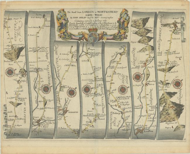
John Ogilby's 'Britannia' was published between 1675 and 1698. It is a landmark in the mapping of England and Wales. Its unique format constituted the first national road-atlas of any country in Western Europe. It was composed of maps of seventy-three major roads and cross-roads, presented in a continuous strip-form, on a uniform scale of one inch to a mile. Each beautiful map includes wonderful detail of the countryside with each strip containing a large compass rose to indicate changes in direction.
Despite mentioning London in the title, this attractive strip-style map actually begins in Moreton-in Marsh (Gloucestershire) and continues to Montgomery (Wales) in seven strips totaling approximately 76 miles. Each of the seven panels has a decorative compass rose to orient the traveler, and the strapwork title cartouche at top features the royal coat of arms.
References: Shirley (BL Atlases) T.OGIL-4a #44.
Condition: A
A nice impression with minor toning in the blank margins. There are old tape remnants along the top edge on verso.