Subject: World
Period: 1944 (dated)
Publication:
Color: Printed Color
Size:
39.5 x 26.6 inches
100.3 x 67.6 cm
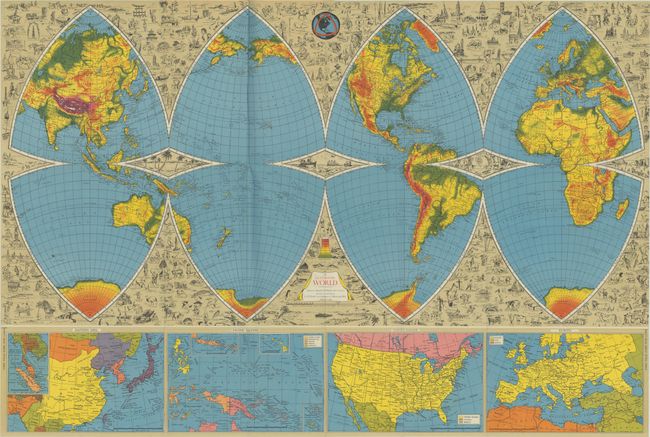
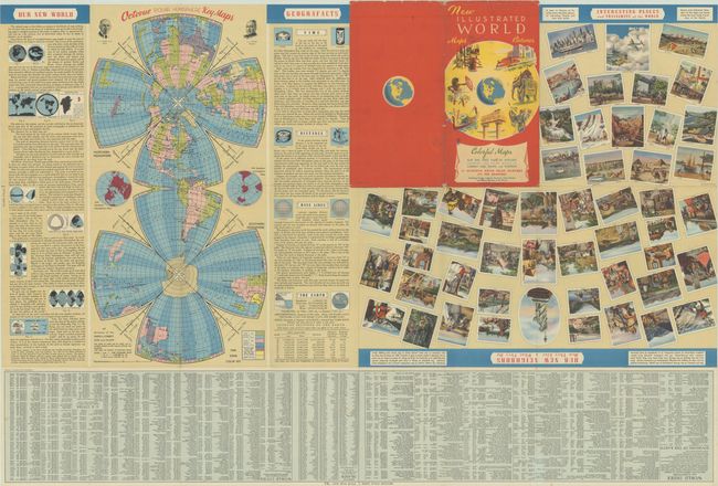
This large and elaborate map was edited by Harold B. Ward in Milwaukee and designed and published by L.E. Pitner. The authors state that this unusual "octovue" projection is "unique in the history of mapmaking. For the first time since the dawn of civilization, you see on this and succeeding pages a complete picture of the earth – a sphere spread out before you on a flat surface, free of distortions either in size, in shape, in distance or in position.” Cartographically, the map presents both political and physical geography, with elevation level indicated by color and range from green (near sea level) to bright red (mountainous). Filling in the gaps between the map are hundreds of detailed vignettes capturing wildlife, places of interest, and culture throughout the world. Along the bottom border are inset maps of Eastern Asia, Pacific Islands, United States and Europe. The verso is filled with related text, additional illustrations, and another octovue map. Folds into red pictorial wrappers with title "New Illustrated World Maps Pictures Octovue."
References:
Condition: B+
A colorful example with an archivally repaired 1.5" fold separation at bottom and a few tiny splits at the fold junctions. Covers have some light wear and chipping along the edges.