Subject: London, England
Period: 1741 (dated)
Publication:
Color: Hand Color
Size:
22.3 x 19.3 inches
56.6 x 49 cm
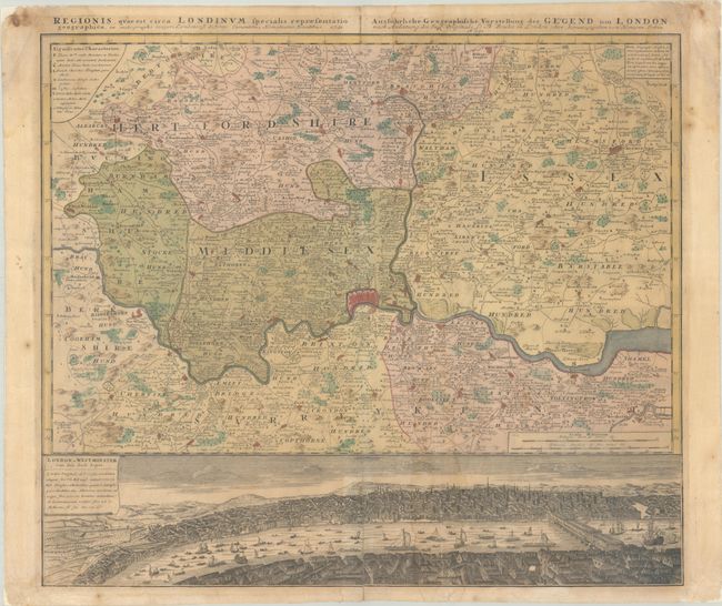
This very detailed map centered on London was originally produced by Thomas Bowles. It covers the vicinity from Maidenhead to Rochester. The map extends to include P. High Wickham, Chelmsford, Bishops Stratfort, and below Rochester. The lower quarter is a bird's-eye view of London and Westminster from Southwark from across the Thames, which is densely filled with boats and ships of all description. The legend uses icons to locate towns, market towns, parish churches, gentlemen's houses, castles, wind and water mills, and villages.
References: Howgego #88.
Condition: B
Full contemporary color on watermarked paper with light toning and dampstaining, and a long vertical crease to the right of the centerfold. The sheet edges have been reinforced on verso with archival materials.