Subject: Central England
Period: 1645 (circa)
Publication:
Color: Hand Color
Size:
19.6 x 16.3 inches
49.8 x 41.4 cm
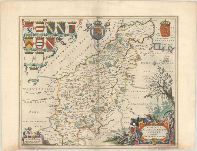
Exquisite county map of Northhamtonshire with Blaeu's typical fine engraving and composition, clear topographical information, and profuse decorative elements. The top of the map is filled with the royal coat of arms and heraldic shields of various local noblemen, and at bottom is a delightfully illustrated title cartouche and scale featuring two putti. French text on verso, published between 1645-48.
References: Van der Krogt (Vol. II) #5315:2.
Condition: B+
A nice impression on a sheet that has been trimmed close to the bottom border. Along this border there are minor dampstains and several small wormholes that have been backed with linen tape on verso.