Subject: Central England
Period: 1610 (dated)
Publication: The Theatre of the Empire of Great Britaine
Color: Hand Color
Size:
20.1 x 15.1 inches
51.1 x 38.4 cm
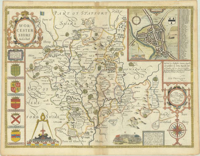
This classic decorative county map of Worcestershire is from John Speed’s important English atlas. It divides the county into its hundreds and shows towns and cities, parks, hills, rivers, and more. Besides presenting the most up-to-date information in his maps, Speed also included detailed city plans; here showing Worcester in the top right corner complete with coat of arms, distance scale, and key to important places. The map is further decorated by various coats of arms for the region, a vignette depicting the 1265 Battle of Evesham, elegant title cartouche, compass rose, and distance scale with dividers. Engraved by Jodocus Hondius. Published by Basset & Chiswell in 1676. English text on verso.
References: Shirley (BL Atlases) T.SPE-1j.
Condition: B+
A nice impression on fleur-de-lis watermarked paper with light toning along the centerfold and sheet edges. There are archival repairs to a tiny centerfold separation at top and an edge tear in the bottom margin. There are old tape remnants along the top edge on verso.