Subject: Northern England
Period: 1610 (dated)
Publication: The Theatre of the Empire of Great Britaine
Color: Hand Color
Size:
20.2 x 15.1 inches
51.3 x 38.4 cm
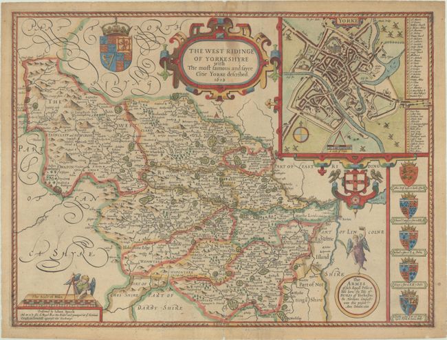
This classic decorative county map of West Riding is divided into wapentakes and locates towns, cities, rivers, forests, hills, and parks. Locates Leeds, Wakefield, Bradford, and York along the River Ouse. A city plan of York is also shown in the top right corner complete with compass rose, distance scale, and key to important places. The map is further decorated by coats of arms for the Duke of York, strapwork title cartouche, and distance scale with an angel holding dividers. This is from the uncommon Roger Rea edition, published circa 1650. Blank verso.
References: Shirley (BL Atlases) T.SPE-1h.
Condition: B
On a lightly toned sheet of paper with a fleur-de-lis watermark. There is some light staining at top center and short centerfold separations at top and bottom that have been closed on verso with archival tape.