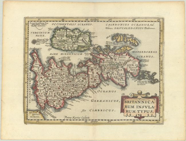
Subject: Britain
Period: 1676 (published)
Publication: Introductionis in Universam Geographiam
Color: Hand Color
Size:
7.9 x 6.1 inches
20.1 x 15.5 cm
This is a reduced version of Jansson's historical map of the British Isles after Abraham Ortelius and engraved by Pieter van den Keere (Petrus Kaerius). North is oriented to the right. Hadrian's wall stands as a major feature. The map is embellished with a large title cartouche.
Cluver's Introductio in Universam Geographicam was a popular atlas, appearing in over 45 editions during a 100-year period. The first edition was published without maps in the 1620s, and the first edition to include maps was published circa 1641. The various editions were published in different cities throughout Europe, including Amsterdam, Nuremberg, and London, often with new sets of maps engraved. This map is from an Amsterdam edition published by Jansson's heirs, which included some maps from Jansson's Atlas Minor.
References: Shirley (BL Atlases) T.CLUV-6a #10.
Condition: A
A dark impression on a bright sheet with light toning along the edges.