Subject: Britain
Period: 1580 (circa)
Publication: Diporti Notturni
Color: Hand Color
Size:
3.5 x 5.2 inches
8.9 x 13.2 cm
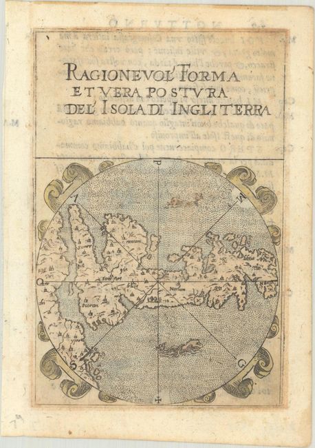
This rare little map was published in Captain Francesco Ferretti's pocket-sized volume on military strategy, which was issued in 1580, 1604 and 1608. The work included 28 maps of islands, many copied after maps by Girolamo Porro, each in a circular frame decorated with strapwork and sea monsters, with the title in a panel at top. The map of Britain is oriented with north to the right and is devoid of Ireland, despite the fact that the coastline of mainland Europe is shown. Interestingly, the map of Britain was the only island depicted in Ferretti's volume that was not a Mediterranean island. Italian text on verso.
References: King (3rd ed.) #1580; Shirley (British Isles to 1650) #124.
Condition: B+
Light toning on a watermarked sheet with a few tiny worm holes just outside of the image at top left.