Subject: Europe
Period: 1676 (published)
Publication: Introductionis in Universam Geographiam
Color: Hand Color
Size:
10.1 x 7.3 inches
25.7 x 18.5 cm
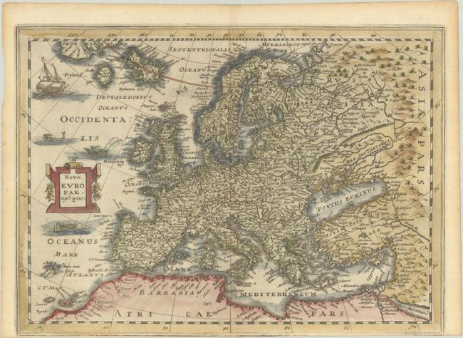
This lovely map is a reduced-size edition of Gerard Mercator's folio map of Europe, extending to include part of Greenland, Iceland, and the mythical island of Frisland. It is adorned with a sailing ship, two sea monsters, and a decorative title cartouche. This map was originally engraved for for Cloppenburgh's atlas.
Cluver's Introductio in Universam Geographicam was a popular atlas, appearing in over 45 editions during a 100-year period. The first edition was published without maps in the 1620s, and the first edition to include maps was published circa 1641. The various editions were published in different cities throughout Europe, including Amsterdam, Nuremberg, and London, often with new sets of maps engraved. This map is from an Amsterdam edition published by Jansson's heirs, which included some maps from the Jansson and Cloppenburgh editions of Atlas Minor.
References: Shirley (BL Atlases) T.CLUV-6a #4; Van der Krogt (Vol. III) #1000:353.
Condition: B+
A generally nice impression that is weak along the bottom neatline. There is light toning along the edges of the sheet, and the map was trimmed by the bookbinder with loss of the bottom margin.