Subject: Canary Islands & Madeira
Period: 1780 (circa)
Publication: Atlas de Toutes les Parties Connues du Globe Terrestre
Color: Hand Color
Size:
7.9 x 12.2 inches
20.1 x 31 cm
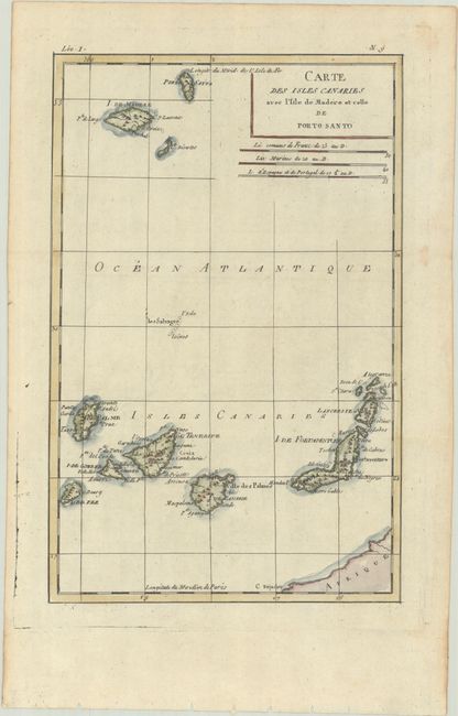
This copper engraved map of the Canary Islands includes the islands of Porto Santo, de Madere, Tenerife, Palme, de Fer, de Canarie and Fortaventure. There are three distance scales including French leagues, marine leagues, and Spanish leagues.
Rigobert Bonne was an important French cartographer of the late 18th century. In 1773 he succeeded Jacques Bellin as the royal cartographer in the office of the Hydrographer at the Depot de la Marine. Working in his official capacity, Bonne compiled some of the most detailed and accurate maps of the period.
References:
Condition: A
A crisp impression, issued folding on a bright sheet with a "CB" watermark, binding holes along the bottom edge of the sheet, and a few spots of foxing that are confined to the edges of the sheet.