Current Auction
"[Lot of 2] Carte du Perou avec une Partie des Pays qui en sont a l'Est [and] Scenographischer Abriss von der Stadt de los Reyes (Koenigsstadt) oder Lima... / Plan Senographique de la Cite des Rois ou Lima..."
Subject: Peru & Lima
Period: 1774-80 (circa)
Publication:
Color: Black & White
Size:
See Description
Download High Resolution Image
(or just click on image to launch the Zoom viewer)
(or just click on image to launch the Zoom viewer)
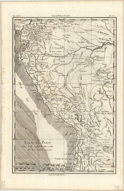
A. Carte du Perou avec une Partie des Pays qui en sont a l'Est, by Rigobert Bonne, circa 1780 (8.3 x 12.5"). Attractive regional map of the western coast of South America extending from Ecuador, through Peru and present-day Bolivia, into northern Chili. There is nice detail with the locations of numerous missions and many other place names throughout. The directions of the trade-winds are shown in the Pacific. Condition: A dark impression with foxing along the left edge of the sheet. (A)
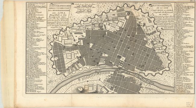
B. Scenographischer Abriss von der Stadt de los Reyes (Koenigsstadt) oder Lima... / Plan Senographique de la Cite des Rois ou Lima..., by Jacques Nicolas Bellin, circa 1774 (14.3 x 7.8"). Detailed plan of the city of Lima with titles and keys in both French and Dutch. The key lists 70 major sites and buildings. Condition: Close margin at top and right, as issued. A bit of light foxing. (B+)
References:
Condition:
See description above.
Estimate: $100 - $130
Current High Bid:
$0
Reserve: Reserve Not Met
Next Bid: $50
Bid Increments
$50 - $99$5
$100 - $249$10
$250 - $499$25
$500 - $999$50
Terms & Conditions