Current Auction
"[Lot of 2] Colonies Francaises Martinique. Amerique du Sud [and] Colonies Francaises (en Amerique.)", Levasseur, Victor
Subject: Martinique & Guadeloupe
Period: 1840 (circa)
Publication: Atlas National Illustre
Color: Hand Color
Size:
16.6 x 10.8 inches
42.2 x 27.4 cm
Download High Resolution Image
(or just click on image to launch the Zoom viewer)
(or just click on image to launch the Zoom viewer)
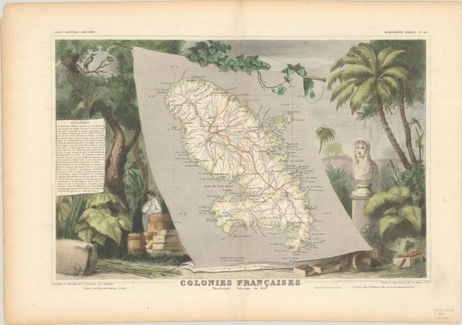
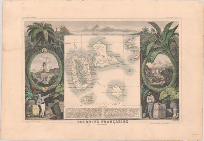
Victor Levasseur's "Atlas National Illustre" and "Atlas Universel Illustre" are among the last decorative atlases published. The maps are all lavishly illustrated with scenes of the countryside, products and activities indigenous to the region.
A. Colonies Francaises Martinique. Amerique du Sud. Lovely map of the island of Martinique displayed on a banner scroll, surrounded by steel engraved vignettes featuring the riches of the colony. Empress Josephine, the wife of the Emperor Napoleon, was born on this island, and is shown in a bust at the right. Engraved by Laguillermie.
B. Colonies Francaises (en Amerique.). This map of Guadeloupe includes an inset of St. Martin. The surrounding engravings feature the rich produce of the islands including sugar, cotton, cocoa, tobacco, and coffee. It also depicts an earthquake.
References:
Condition: B+
Contemporary outline color in the maps with later color in the decorative surround and a few tiny tears along the edges of the sheets. The map of Martinique has light toning along the edges of the sheet. The map of Guadeloupe has faint dampstains at top left and at bottom.
Estimate: $80 - $100
Current High Bid:
$0
Reserve: Reserve Not Met
Next Bid: $40
Bid Increments
Under $50$1
$50 - $99$5
$100 - $249$10
$250 - $499$25
$500 - $999$50
Terms & Conditions