Current Auction
"Geographical, Statistical, and Historical Map of Porto Rico and the Virgin Islands", Carey & Lea
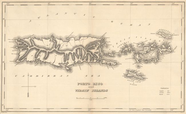
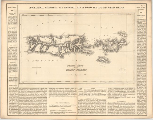
Subject: Puerto Rico & Virgin Islands
Period: 1827 (published)
Publication: A Complete Historical, Chronological, and Geographical American Atlas
Color: Black & White
Size:
17.2 x 10.4 inches
43.7 x 26.4 cm
Download High Resolution Image
(or just click on image to launch the Zoom viewer)
(or just click on image to launch the Zoom viewer)
The map is on a full folio sheet (21.9 x 17.5") with English text giving a brief description of the islands, chief towns, population, government, and history. It shows good detail along the coastline with only topography represented in the interior. Engraved by Fielding Lucas and engraved by Kneass.
This is the first time we have encountered this map in black & white.
References: Phillips (Atlases) #1177-43.
Condition: A
A crisp impression on a clean sheet with a couple of tiny holes along the lower centerfold (below the map image).
Estimate: $200 - $230
Current High Bid:
$0
Reserve: Reserve Not Met
Next Bid: $100
Bid Increments
$100 - $249$10
$250 - $499$25
$500 - $999$50
$1,000 - $2,499$100
Terms & Conditions